
파일:Limpopo.jpg
미리 보기 크기: 800 × 526 픽셀 다른 해상도: 320 × 210 픽셀 | 640 × 421 픽셀 | 1,024 × 673 픽셀 | 1,280 × 841 픽셀 | 1,681 × 1,105 픽셀
원본 파일 (1,681 × 1,105 픽셀, 파일 크기: 533 KB, MIME 종류: image/jpeg)
파일 설명
| Creator | Department of Defense. American Forces Information Service. Defense Visual Information Center. 1994 | |||||||||||||||||||
| 제목 |
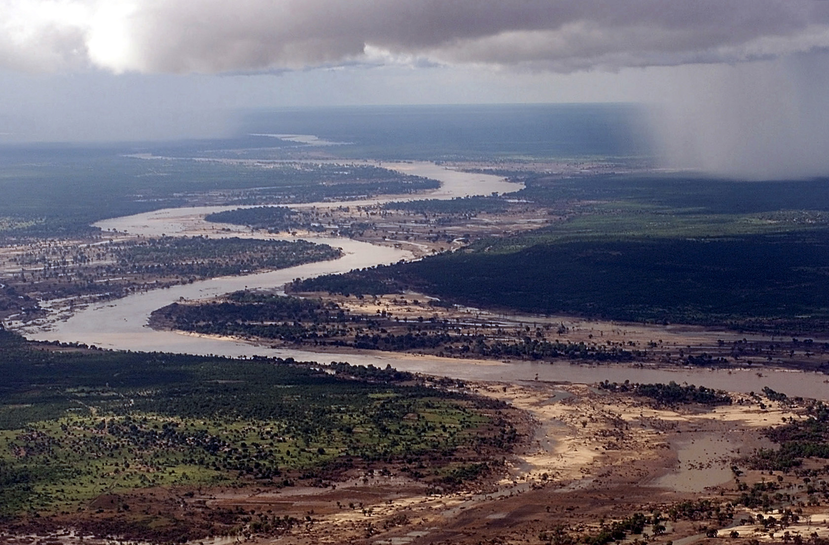
Aerial view, extreme long shot, looking down as the Limpopo River winds its way through Southern Mozambique, where it recently crested its banks and sent floodwaters rushing through towns and farmland, forcing people from their homes and wreaking havoc with the countries infrastructure. Even though waters have receded over the past week, heavy rains seen in the distance, continue to threaten the region with more flooding. C-130 aircraft (not shown), assigned to the 37th Airlift Squadron at Ramstein Air Base, Germany, fly daily Keen Sage aerial surveillance missions over Mozambique to help find stranded flood victims and survey flood levels and damage caused by the flooding in Southern... |
|||||||||||||||||||
| 설명 |
The original finding aid described this photograph as: [Complete] Scene Caption: Aerial view, extreme long shot, looking down as the Limpopo River winds its way through Southern Mozambique, where it recently crested its banks and sent floodwaters rushing through towns and farmland, forcing people from their homes and wreaking havoc with the countries infrastructure. Even though waters have receded over the past week, heavy rains seen in the distance, continue to threaten the region with more flooding. C-130 aircraft (not shown), assigned to the 37th Airlift Squadron at Ramstein Air Base, Germany, fly daily Keen Sage aerial surveillance missions over Mozambique to help find stranded flood victims and survey flood levels and damage caused by the flooding in Southern Africa. The 37th Airlift Squadron C-130 aircraft, are deployed to Hoedspruit Air Force Base, South Africa, as part of the United States Operation Atlas Response, humanitarian relief efforts. Subject Operation/Series: ATLAS RESPONSE Base: Hoedspruit Air Force Base Country: South Africa (ZAF) Scene Camera Operator: TSGT Cary Humphries Release Status: Released to Public |
|||||||||||||||||||
| 날짜 | 2000년 3월 10일 | |||||||||||||||||||
| Collection |
|
|||||||||||||||||||
| 출처/촬영자 |
|
|||||||||||||||||||
| 저작권 (이 파일을 인용하기) |
|
|||||||||||||||||||
| Standardized rights statement |
|
|||||||||||||||||||

파일 역사
날짜/시간 링크를 클릭하면 해당 시간의 파일을 볼 수 있습니다.
| 날짜/시간 | 섬네일 | 크기 | 사용자 | 설명 | |
|---|---|---|---|---|---|
| 현재 | 2009년 8월 27일 (목) 05:45 | | 1,681 × 1,105 (533 KB) | BetacommandBot | move approved by: User:Angr This image was moved from File:DF-SD-01-00934.jpg Category:Aerial photographs of Mozambique Category:Limpopo River {{Information| |Description={{en|Aerial view, extreme long shot, looking down as the Limpopo |
이 파일을 사용하는 문서
이 파일을 사용하고 있는 모든 위키의 문서 목록
다음 위키에서 이 파일을 사용하고 있습니다:
- af.wikipedia.org에서 이 파일을 사용하고 있는 문서 목록
- ar.wikipedia.org에서 이 파일을 사용하고 있는 문서 목록
- arz.wikipedia.org에서 이 파일을 사용하고 있는 문서 목록
- ast.wikipedia.org에서 이 파일을 사용하고 있는 문서 목록
- as.wikipedia.org에서 이 파일을 사용하고 있는 문서 목록
- azb.wikipedia.org에서 이 파일을 사용하고 있는 문서 목록
- az.wikipedia.org에서 이 파일을 사용하고 있는 문서 목록
- ba.wikipedia.org에서 이 파일을 사용하고 있는 문서 목록
- be-tarask.wikipedia.org에서 이 파일을 사용하고 있는 문서 목록
- beta.wikiversity.org에서 이 파일을 사용하고 있는 문서 목록
- be.wikipedia.org에서 이 파일을 사용하고 있는 문서 목록
- bg.wikipedia.org에서 이 파일을 사용하고 있는 문서 목록
- bh.wikipedia.org에서 이 파일을 사용하고 있는 문서 목록
- bn.wikipedia.org에서 이 파일을 사용하고 있는 문서 목록
- br.wikipedia.org에서 이 파일을 사용하고 있는 문서 목록
- br.wiktionary.org에서 이 파일을 사용하고 있는 문서 목록
- ca.wikipedia.org에서 이 파일을 사용하고 있는 문서 목록
- ceb.wikipedia.org에서 이 파일을 사용하고 있는 문서 목록
- ckb.wiktionary.org에서 이 파일을 사용하고 있는 문서 목록
- cs.wikipedia.org에서 이 파일을 사용하고 있는 문서 목록
- cy.wikipedia.org에서 이 파일을 사용하고 있는 문서 목록
- de.wikipedia.org에서 이 파일을 사용하고 있는 문서 목록
- el.wikipedia.org에서 이 파일을 사용하고 있는 문서 목록
- en.wikipedia.org에서 이 파일을 사용하고 있는 문서 목록
- en.wikiquote.org에서 이 파일을 사용하고 있는 문서 목록
- en.wikiversity.org에서 이 파일을 사용하고 있는 문서 목록
- en.wiktionary.org에서 이 파일을 사용하고 있는 문서 목록
- eo.wikipedia.org에서 이 파일을 사용하고 있는 문서 목록
이 파일의 더 많은 사용 내역을 봅니다.